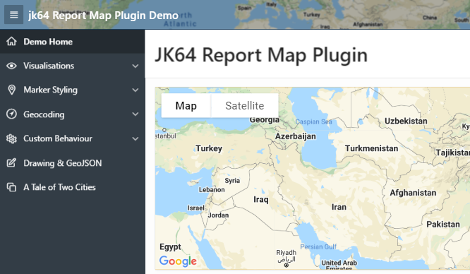
Report Map (Google Maps) 

A region plugin for Oracle Application Express
Leverage the power of Google Maps in your APEX application. This plugin allows you to add one or more Google Map regions to any page, showing a number of markers (pins) retrieved from a query or other data source you specify.
The plugin provides a rich array of built-in declarative features, dynamic actions and associated API routines, and gives access to the underlying Google Maps object so you can customise it with any other behaviour you need.
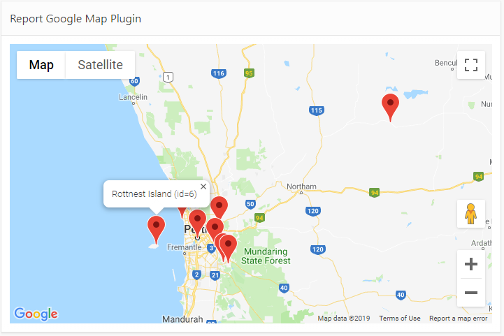
The user can click any marker to see a popup info window for it.
Visualisation: Marker Clustering
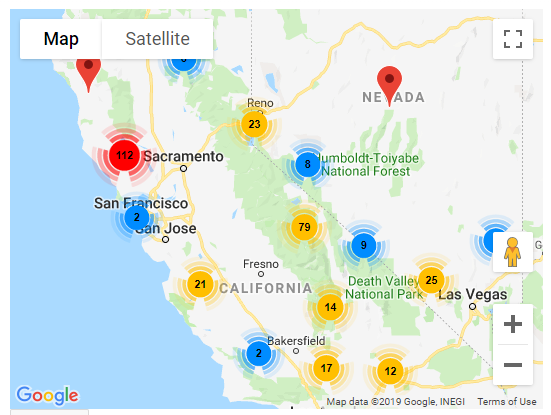
If many pins are too close together, Marker Clustering merges them into a single cluster; the number indicates how many pins are at that location. As the user zooms in or out, the clusters will split up or merge as needed.
Visualisation: Spiderfier
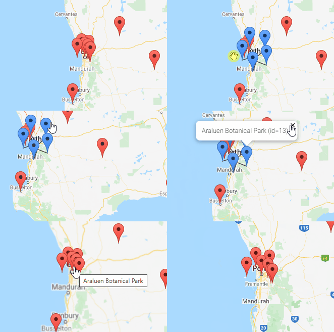
If many pins are too close together or overlapping, the Spiderfier shifts them when clicked into a ring or spiral with lines pointing back to their original location.
Visualisation: Heatmap
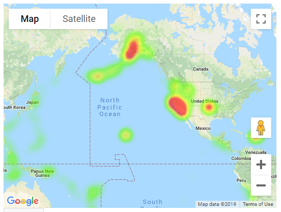
This is suitable for a large volume of data points. Each data point can have a “weight” which indicates the magnitude of some measure.
Visualisation: Directions
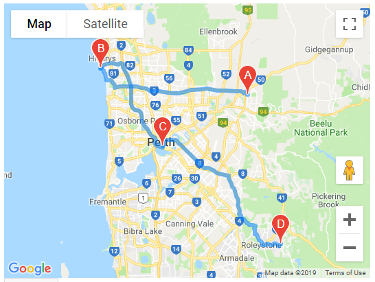
Up to 10 points (origin, destination, plus up to 8 waypoints) may be supplied to derive a route. Google Maps can generate a route for Driving, Walking, Bicycling, or Transit (public transport). The plugin can also get the calculated total Distance and Time for the route.
Visualisation: Info Layer
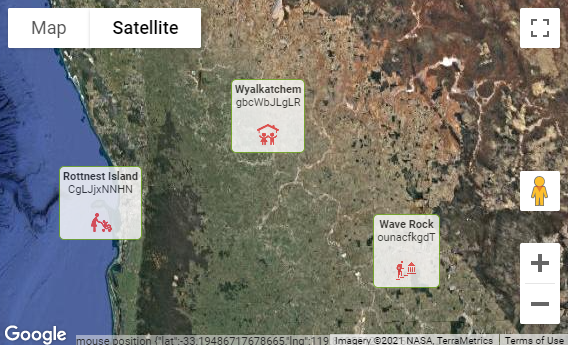
Renders the Info column containing any arbitrary HTML (including text, formatting, icons, and images) on the map.
Drawing & GeoJSON
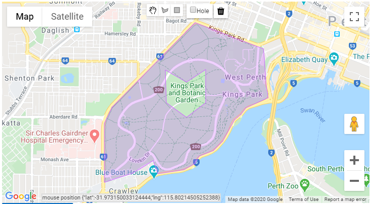
Allow users to interactively draw shapes (points, lines, polygons, and holes in polygons) onto the map. Export the shapes as a GeoJSON document. Load shapes from a GeoJSON document.
DEMO
PRE-REQUISITES
-
Oracle Application Express 18.2 or later
NOTE: Release 1.3.1 was the last version that includes a backport for versions prior to APEX 18.2.
-
Your Google Maps API Key
Google provides a free monthly credit which includes thresholds for some API requests (some are unlimited). You can use the platform to set daily quotas and email alerts to control your monthly costs. Refer to the pricing information page for details.
Make sure to restrict your API key to your domain, especially if your website will be accessible on the internet. You can modify this at any time as required.
INSTALLATION INSTRUCTIONS
NOTE: if you are upgrading from any version prior to 1.0 (i.e. 0.x), some changes will be required to your application to support it as a number of attributes have been removed or changed.
-
Download the latest release
-
In your application, go to Shared Components -> Plug-ins and click Import
-
Import the region plugin:
region_type_plugin_com_jk64_report_google_map_r1.sql -
Supply your public Google API Key (Component Settings)
-
Add a region to the page, select type JK64 Report Google Map R1 [Plug-In]
-
For SQL Source, enter a query with at least 4 columns, for example:
SELECT lat, lng, name, id FROM mydata(if you just want a map with no data, enter a dummy query (e.g.
select 1 from dual); then in the map region properties, set Source -> Location to- Select -) -
(OPTIONAL) To add dynamic action features, import the companion Dynamic Action plugins:
dynamic_action_plugin_com_jk64_report_google_map_da_r1.sqldynamic_action_plugin_com_jk64_report_google_map_directions_da.sql
IF YOU ARE UPGRADING from any prior release, refer to the Upgrade Notes.
SUPPORT
-
In APEX, select any attribute and view the Help for more information and helpful tips.
-
Refer to the WIKI for sample queries, plugin attributes, triggers, API references, and other tips & tricks.
-
If you encounter a bug or have a great idea for enhancement, please raise an Issue. I will endeavour to respond to each issue as quickly as possible.
